GPS Sensor#
Introduction#
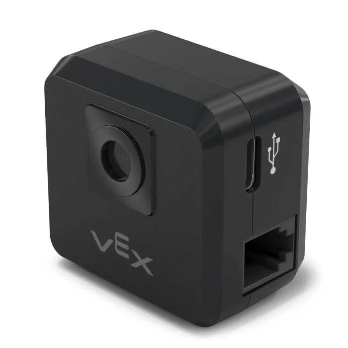
The gps class is used to control and access data from the V5 GPS (Game Positioning System™) Sensor. This sensor provides accurate position and orientation tracking for a robot on the VEX Field. It uses the GPS Field Code around the Field’s perimeter to calculate the robot’s X and Y coordinates and heading in real time.
The GPS Sensor returns the robot’s position using a reference point automatically calculated from the offsets entered when configuring the GPS Sensor in the Devices window.
For more information about the GPS Sensor, read Using the GPS Sensor with VEX V5 in the VEX Library.
The reference point acts as the GPS Sensor’s own (0, 0) position where all coordinates, headings, and movements returned by GPS methods are relative to this configured point.
Class Constructors#
1 — Creates a
gpsobject on the specified Smart Port using the default origin (0, 0).gps( int32_t index, double heading_offset = 0, turnType dir = right );
2 — Creates a
gpsobject on the specified Smart Port and defines a custom origin position.gps( int32_t index, double ox, double oy, distanceUnits units = mm, double heading_offset = 0, turnType dir = right );
Class Destructor#
Destroys the gps object and releases associated resources.
~gps();
Parameters#
Parameter |
Type |
Description |
|---|---|---|
|
|
The Smart Port that the GPS Sensor is connected to, written as |
|
|
The X-coordinate of the origin position. |
|
|
The Y-coordinate of the origin position. |
|
|
The unit of measurement used for
|
|
|
The GPS Sensor’s rotational offset in degrees, from 0.00 to 359.99. Default is 0. |
|
|
The direction that will return positive heading values:
|
Examples#
// Create the gps instance
gps GPS1 = gps(
    PORT1,      // Smart Port 1
    180);       // heading_offset
// Create the gps instance
gps GPS1 = gps(
    PORT1,   // Smart Port 1
    50.00,   // ox
    100.00,  // oy
    mm,      // units
    180 );   // heading_offset
Member Functions#
The gps class includes the following member functions:
calibrate— Calibrates the GPS Sensor.setOrigin— Sets the origin position for the GPS coordinate system.setLocation— Sets the current location and heading of the GPS Sensor.xPosition— Returns the current X position.yPosition— Returns the current Y position.heading— Returns the current heading.acceleration— Returns linear acceleration along the specified axis.gyroRate— Returns the angular velocity for the specified axis.orientation— Returns the orientation for the specified axis.quality— Returns the current GPS signal quality.changed— Registers a callback function that runs when GPS data changes.
Before calling any gps member functions, a gps instance must be created, as shown below:
/* This constructor is required when using VS Code.
GPS Sensor configuration is generated automatically
in VEXcode using the Device Menu. Replace the values
as needed. */

// Create the gps instance in Smart Port 1
gps GPS1 = gps(PORT1);
Class Methods#
calibrate#
Calibrates the GPS Sensor. This will set the GPS’ configured heading (according to its angle offset) as the current heading of the Drivetrain.
The GPS Sensor must remain still during the calibration process.
Available Functionsvoid calibrate();
This function does not take any parameters.
Return ValuesThis function does not return a value.
Examples// Turn to face the lower Field wall using data from the GPS Sensor.
GPS1.calibrate();
Drivetrain.turnToHeading(180, degrees)
setOrigin#
Sets the origin of the GPS coordinate system.
Available Functions1 — Sets the origin to the specified X and Y position.
void setOrigin(
  double        x,
  double        y,
  distanceUnits units = mm );
Parameters2 — Sets the origin to the sensor’s current position.
void setOrigin();
Parameter |
Type |
Description |
|---|---|---|
|
|
The X-coordinate of the new origin position. |
|
|
The Y-coordinate of the new origin position. |
|
|
The unit of measurement used for
|
This function does not return a value.
NotessetLocation#
Sets the current GPS position and heading.
Available Functions1 — Sets the current location using specified distance and rotation units.
void setLocation(
  double        x,
  double        y,
  distanceUnits units = mm,
  double        angle = 0,
  rotationUnits units_r = degrees );
Parameters2 — Sets the current location using millimeters and degrees.
void setLocation( double x, double y, double angle );
Parameter |
Type |
Description |
|---|---|---|
|
|
The X-coordinate of the current location. |
|
|
The Y-coordinate of the current location. |
|
|
The unit of measurement used for
|
|
|
The heading value for the current location. |
|
|
The unit of measurement used for
|
This function does not return a value.
NotesxPosition#
Returns the current X position of the GPS Sensor.
Available Functionsdouble xPosition( distanceUnits units = distanceUnits::mm );
Parameter |
Type |
Description |
|---|---|---|
|
|
The unit of measurement for the returned X position:
|
Returns a double representing the x positional offset from the origin in the specified units.
The X position is measured relative to the current origin.
The origin may be changed using
setOrigin.
// Drive slowly towards the center of the Field
Drivetrain.setDriveVelocity(20.0, percent);
Drivetrain.drive(forward);
// Stop driving when the GPS returns an x position
// near the center of the Field
waitUntil((GPS1.xPosition(mm) < 0.0));
Drivetrain.stop();
yPosition#
Returns the current Y position of the GPS Sensor.
Available Functionsdouble yPosition( distanceUnits units = distanceUnits::mm );
Parameter |
Type |
Description |
|---|---|---|
|
|
The unit of measurement for the returned Y position:
|
Returns a double representing the Y positional offset from the origin in the specified units.
The Y position is measured relative to the current origin.
The origin may be changed using
setOrigin().
// Drive slowly towards the center of the Field
Drivetrain.setDriveVelocity(20.0, percent);
Drivetrain.drive(forward);
// Stop driving when the GPS reports an y position
// near the center of the Field
waitUntil((GPS1.yPosition(mm) < 0.0));
Drivetrain.stop();
heading#
Returns the current heading (yaw angle) of the GPS Sensor.
Available Functionsdouble heading( rotationUnits units = rotationUnits::deg );
Parameter |
Type |
Description |
|---|---|---|
|
|
The unit of measurement for the returned heading value:
|
Returns a double representing the current heading in the specified units.
The heading value is wrapped between 0 and 360 degrees.
The positive rotation direction is determined by the
dirparameter specified during construction.
// Turn slowly to face the right wall
Drivetrain.setTurnVelocity(20.0, percent);
Drivetrain.turn(right);
// Stop turning when the GPS reports a heading
// greater than 90 degrees
waitUntil((GPS1.heading() > 90.0));
Drivetrain.stop();
acceleration#
Returns the linear acceleration measured by the GPS Sensor along the specified axis.
Available Functionsdouble acceleration(
axisType axis );
Parameter |
Type |
Description |
|---|---|---|
|
|
The axis for which acceleration will be returned:
|
Returns a double representing the acceleration along the specified axis in G (gravitational units).
Acceleration values are reported in units of G, where 1 G is equal to the acceleration due to gravity at Earth’s surface.
gyroRate#
Returns the angular velocity measured by the GPS Sensor along the specified axis.
Available Functionsdouble gyroRate(
axisType axis,
velocityUnits units );
Parameter |
Type |
Description |
|---|---|---|
|
|
The axis for which angular velocity will be returned:
|
|
|
The unit of measurement for the returned angular velocity:
|
Returns a double representing the angular velocity along the specified axis in the selected units.
orientation#
Returns the orientation angle of the GPS Sensor for the specified axis.
Available Functionsdouble orientation(
orientationType axis,
rotationUnits units );
Parameter |
Type |
Description |
|---|---|---|
|
|
The orientation axis to retrieve:
|
|
|
The unit of measurement for the returned orientation value:
|
Returns a double representing the orientation of the specified axis in the selected units.
quality#
Returns the perceived GPS signal quality.
Available Functionsint32_t quality();
This function does not take any parameters.
Return ValuesReturns an int32_t representing the GPS signal quality as a percentage:
Possible Values |
Description |
|---|---|
|
All reported positional and heading data from the GPS Sensor is valid. |
|
Positional data is no longer being calculated directly from the GPS Field Code and is instead being estimated through alternative means. |
|
Only heading values are valid. As time passes without sufficient scanning of the GPS Field Code, signal quality continues to decrease until |
changed#
Registers a callback function that runs when the GPS heading value changes.
Available Functionsvoid changed(
void (* callback)(void) );
Parameter |
Type |
Description |
|---|---|---|
|
|
A pointer to a function that will be called when the GPS heading value changes. The function must take no parameters and return |
This function does not return a value.